The Exuma Cays are a 120 mile (190 km) chain of small islands running south-east from Nassau, with the deep blue Exuma Sound on their east side and the pale, shallow Exuma Bank on their west. Staniel Cay, roughly in the middle, is the hub: a small settlement with a yacht club, an airstrip, the swimming pigs of Big Major Cay next door, and Thunderball Grotto, the cave made famous by two James Bond films. The water colours here are a depth map in themselves. This guide translates them into typical depths by zone, with anchorages, launches, tides, hazards and draft advice. The satellite depth map for this cell is updated regularly.
What the bottom looks like
- The Exuma Bank (west side): a vast, shallow carbonate platform of white sand, grass patches and sandbars that stretches for dozens of miles. Cruising guides describe much of the bank as 3 to 10 ft (1 to 3 m) at low water. This is where the famous turquoise comes from.
- The cays and their anchorages: sand bottoms with good holding in the lee of the islands, coral heads near rocky shores, and shallow sand bores (bars) that dry at low tide.
- The cuts: passes between the cays connecting the bank to Exuma Sound, with strong tidal current, rocky edges and standing waves when wind opposes tide.
- Exuma Sound (east side): deep ocean, dropping to thousands of feet within a mile of the cays.
- Thunderball Grotto: a hollow limestone islet between Staniel Cay and Big Major, with underwater entrances and a sunlit chamber full of fish.
- The Exuma Cays Land and Sea Park (north of Staniel): a no-take marine reserve of reefs, creeks and sandbars around Warderick Wells and Shroud Cay.
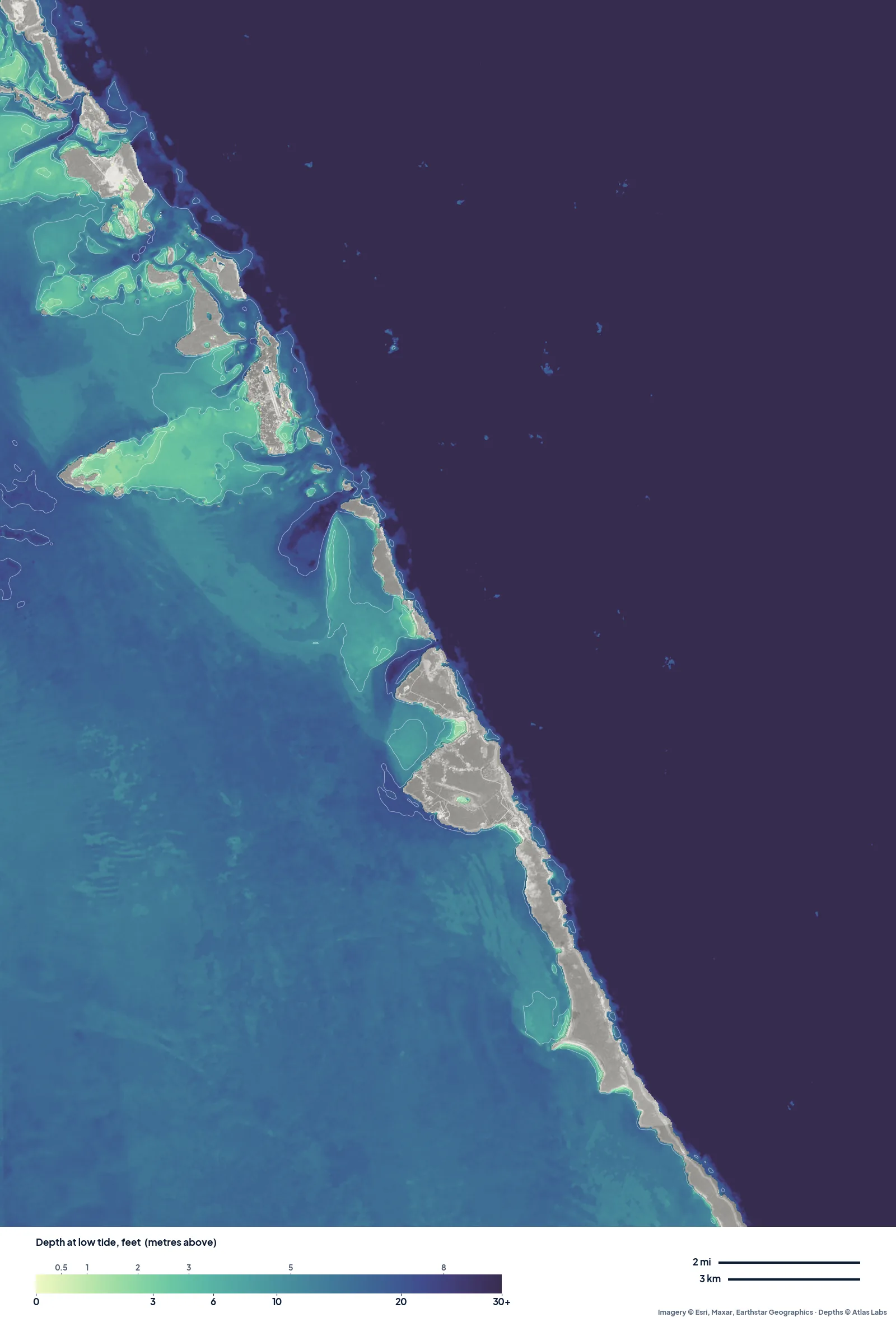
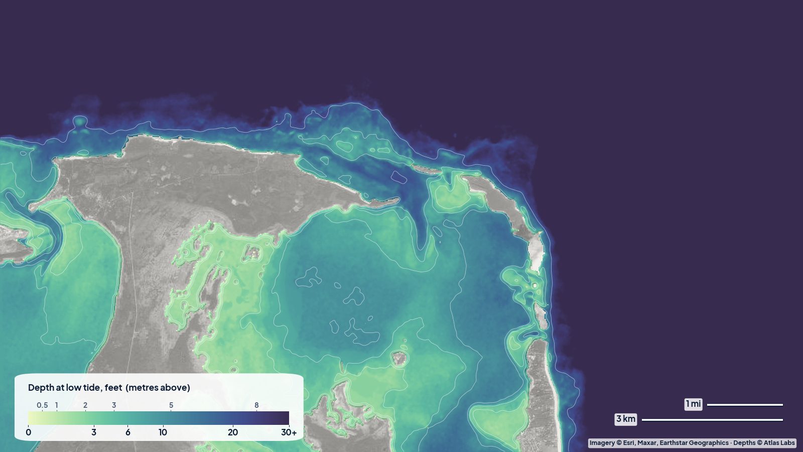
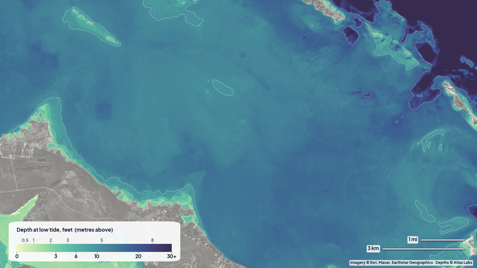
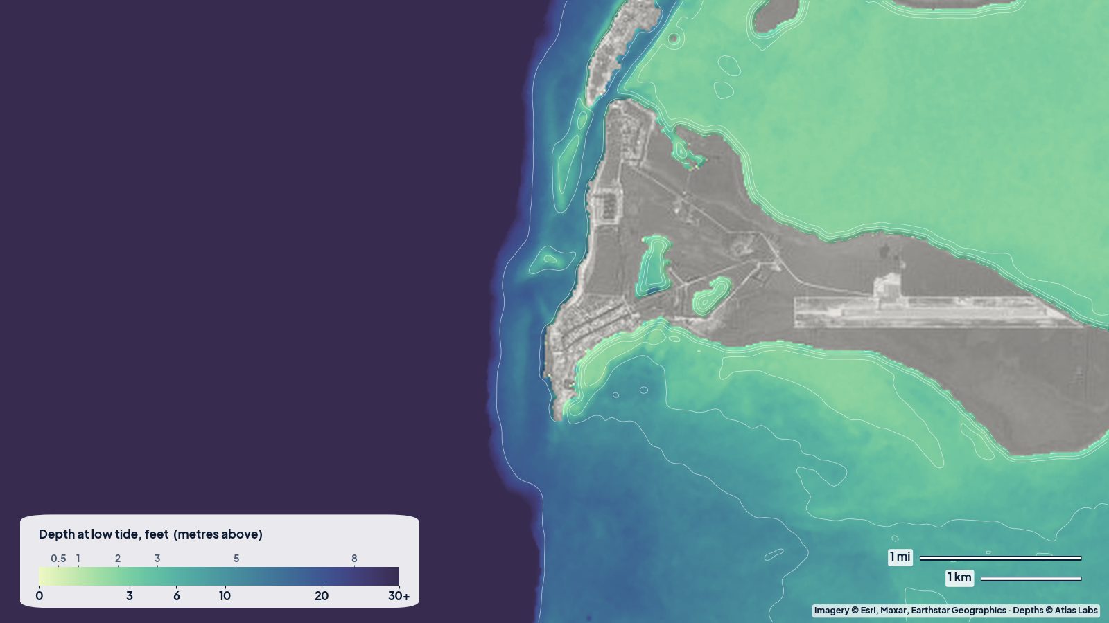
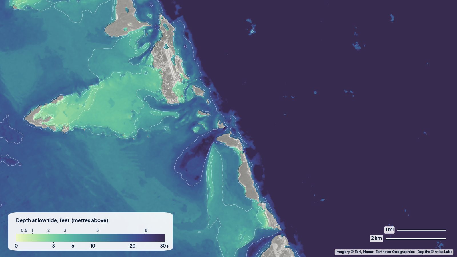
The real depth map of the central Exumas at low tide. Close to the cays the bank is pale green, roughly 6 to 10 ft, deepening to 10 to 15 ft further west; east of the island chain the bottom falls away into Exuma Sound, shown as one dark colour. Tap any spot on the live map for a number.
Approximate depth by zone
Typical ranges only. The tide range is roughly 2.5 to 3.5 ft (0.8 to 1.1 m), which matters enormously on the bank; wind also piles water up or drains it. Check the live map and the tide together.
- Exuma Bank away from the cays: roughly 3 to 10 ft (1 to 3 m) at low water, with sandbars drying.
- Staniel Cay anchorage (between Staniel and Big Major): cruising sources quote roughly 6 to 16 ft (2 to 5 m) over sand with good holding.
- Thunderball Grotto: the surrounding water is roughly 0 to 15 ft (0 to 4.6 m), with the underwater entrances around 10 ft (3 m); at low tide you can swim in with your head above water on the main entrance.
- Pig Beach (Big Major Cay): roughly 1 to 6 ft (0.3 to 1.8 m) off the beach, sand.
- Sandbars around Staniel, Sampson and Pipe Creek: dry to 2 ft (0 to 0.6 m) at low tide, 3 to 5 ft (0.9 to 1.5 m) at high.
- The cuts (Staniel Cay cut, Big Rock Cut, Dotham Cut): roughly 15 to 40 ft (4.6 to 12 m) with currents of 2 to 4 knots.
- Exuma Sound: hundreds to thousands of feet.
Access, launches and anchorages
- Staniel Cay Yacht Club and the government dock: fuel, water, slips, a dinghy dock and the settlement; small planes land at the adjacent airstrip.
- Anchorages: Big Major’s Spot (the pig beach anchorage) and the Staniel Cay anchorage are the main ones, both sand. Mooring balls are available in parts of the Land and Sea Park to the north.
- Kayaks and paddleboards: carried on cruising boats or rented at Staniel; the paddle from the anchorage to Thunderball or Pig Beach is a few hundred yards.
- Day trips from Great Exuma and Nassau: fast boats run tours to Staniel, the pigs, the grotto and the Land and Sea Park; this is how most non-boaters visit.
Best tide, wind and season
- Tide: Cruising guides are blunt: plan all bank passages for high tide if you draw more than about 5 ft (1.5 m), and enter the cuts near slack. Thunderball Grotto is best at low tide and slack water, when the entrances are easiest and the current is weakest. Sandbars are best for walking an hour either side of low tide.
- Wind: The trade wind from the east and south-east is steady; the bank side of the cays is sheltered, the sound side is not. Winter cold fronts bring strong northerlies and westerlies that make the bank anchorages uncomfortable.
- Season: December to April is the cruising high season with the most boats and the coolest weather. Summer is hot and calm with the clearest water and the fewest people. Hurricane season peaks August to October.
Hazards
- Sandbars and coral heads: The bank is a maze of shoals, and the dark patches near the cays are often coral heads. Travel in good light with a bow lookout and read the water colour.
- The cuts: Strong current and dangerous standing waves when wind opposes tide; several cuts have rocky sides and should be transited only at slack or with the tide.
- Current at Thunderball Grotto: It runs hard outside slack and has carried snorkelers away from the islet; go at slack, low tide, and use the dinghy as a safety boat.
- Boat traffic: Tour boats and dinghies crowd the grotto and the pig beach mid-morning to mid-afternoon.
- The pigs: Large and they bite if teased.
- Remoteness: Limited medical help; weather and fuel planning matter.
Kayak and boat draft guidance
Kayaks and paddleboards (4 to 6 in, 10 to 15 cm of draft) can explore the anchorages, the sandbars and the creeks of the Land and Sea Park at any tide, and are the best way to see the shallow bank. Stay out of the cuts.
Cruising monohulls and catamarans drawing 4 to 6 ft (1.2 to 1.8 m) can cross the bank on the marked routes at the right tide and anchor in the main anchorages; anything over about 6 ft (1.8 m) draft needs very careful routing and high tide for all bank passages. Skiffs and dinghies drawing 6 to 18 in (15 to 45 cm) can run most of the shallow bank but still ground on sandbars at low tide. Allow at least 1 ft (0.3 m) above your draft, more on a falling tide.
Frequently asked questions
How deep is the Exuma Bank?
Cruising guides describe much of the bank near the central cays as roughly 3 to 10 ft (1 to 3 m) at low water, with sandbars that dry. Deeper routes exist and are marked in guides.
How deep is Thunderball Grotto?
The water around the islet is roughly 0 to 15 ft (0 to 4.6 m) and the underwater entrances sit near 10 ft (3 m). At low tide and slack water you can swim into the main entrance without diving.
How deep is the anchorage at Staniel Cay?
Roughly 6 to 16 ft (2 to 5 m) over sand with good holding, according to cruising sources. Check the live map for the exact spot.
Can I kayak in the Exumas?
Yes, especially from an anchored boat or a rental at Staniel; the sandbars, the pig beach and the creeks of the Land and Sea Park are easy paddles in the lee of the cays.
When should I visit the Exuma sandbars?
An hour either side of low tide, when the bars are exposed and the water around them is ankle to knee deep.
Related reading
Safety note: ShoalScope depth maps are satellite estimates for planning only and are not for navigation. The Exuma Bank is full of shoals and coral heads. Use official charts and cruising guides, read the water in good light, and transit the cuts at slack.