Bimini is the closest Bahamian island to the United States, about 50 miles (80 km) east of Miami across the Gulf Stream, and it packs two worlds into a few square miles. On the west side the island drops almost immediately into the deep blue of the Stream, which is why big-game fishing and Hemingway made it famous. On the east side, between North Bimini, South Bimini and the small cays, lies a shallow shelf of white sand flats, mangrove creeks and seagrass in 0 to 5 ft (0 to 1.5 m) of gin-clear water, famous for bonefish and now reachable by fast ferry and day trip. This guide covers the harbour, the flats, the wreck and the reefs, with typical depths, access, tides and hazards. The satellite depth map for this cell is updated regularly.
What the bottom looks like
- Bimini Harbour (between North and South Bimini): a dredged channel from the west entrance leading to marinas on North Bimini and the resort basin, with sand and grass outside the channel and shoals at the entrance.
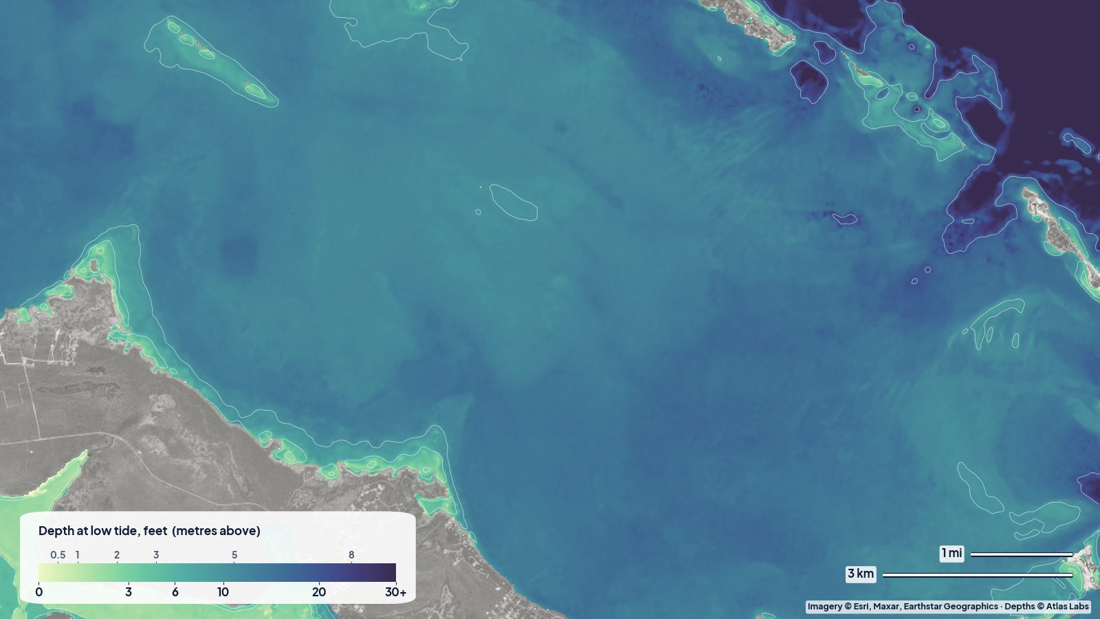
- The East Bimini flats: broad, bright sand flats and seagrass beds on the east side of the islands, cut by mangrove creeks (Bonefish Hole, the Bimini creeks) and bordered by small cays to the south.
- The Sapona wreck and the South Cat Cay flats (south of South Bimini): a concrete-hulled ship wreck standing in shallow water, surrounded by sand, grass and patch reef that is a classic snorkel and freedive site.
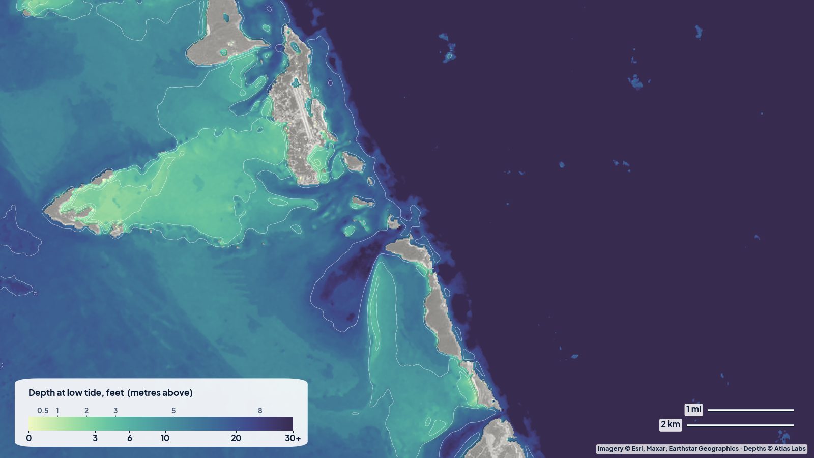
- Western shore and the reefs: a narrow strip of sand beach with reefs and the famous Bimini Road rock formation in shallow water, then the shelf edge and the Gulf Stream.
- Great Bahama Bank (east of the flats): an immense shallow platform of roughly 6 to 25 ft (1.8 to 7.6 m) stretching toward Andros.
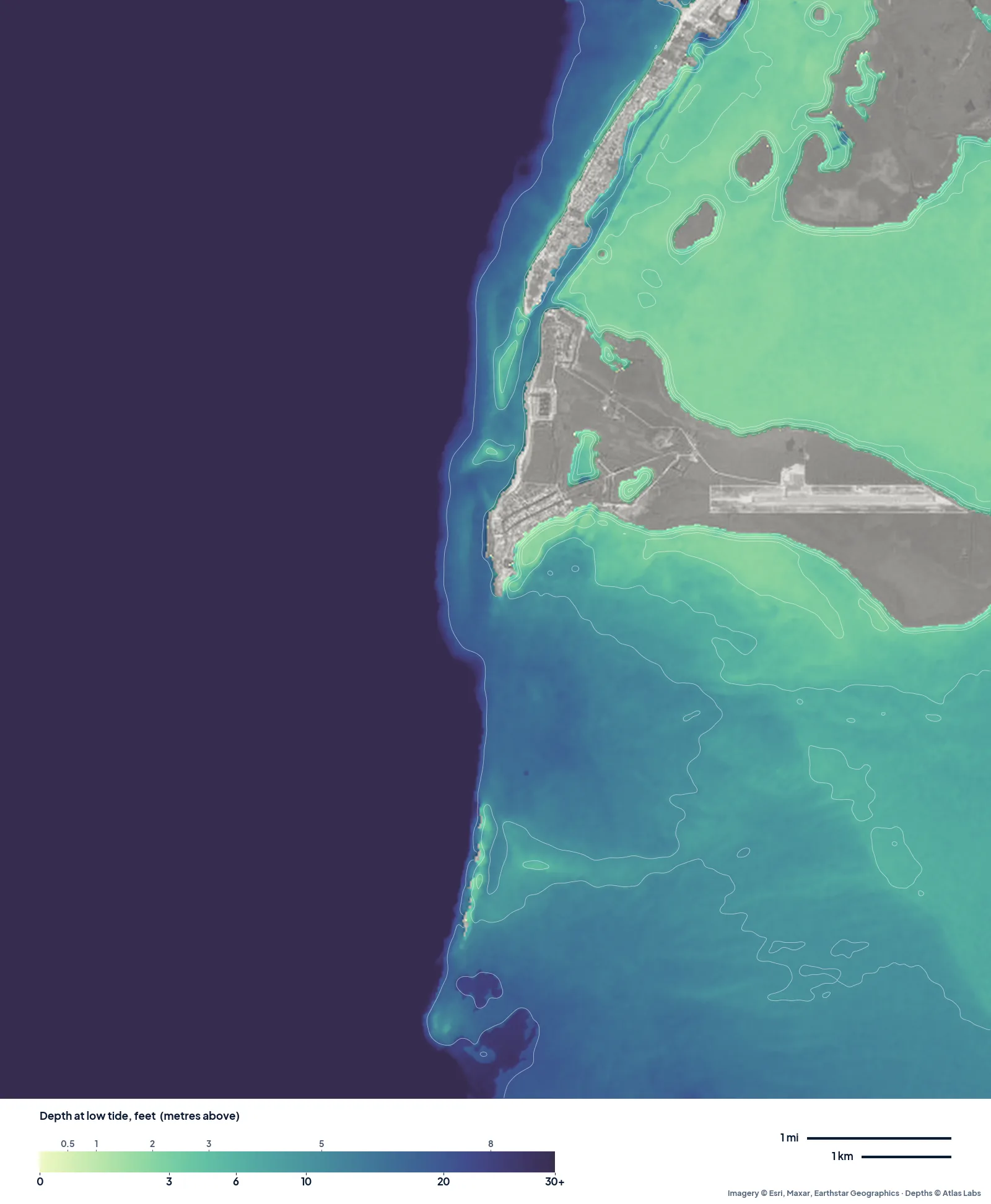
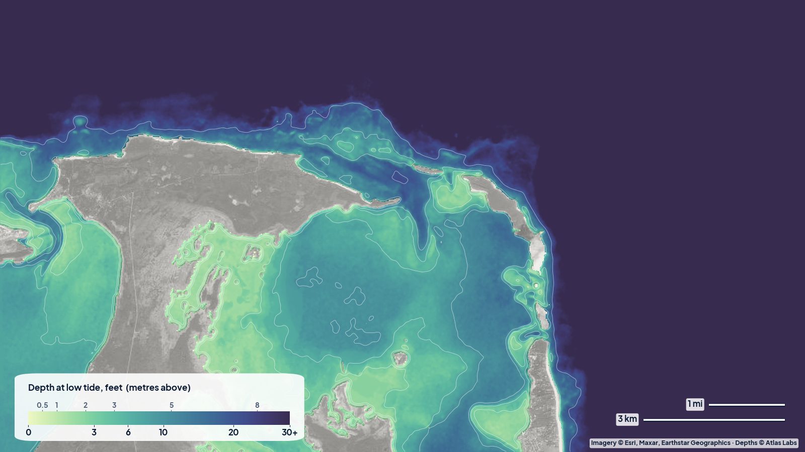
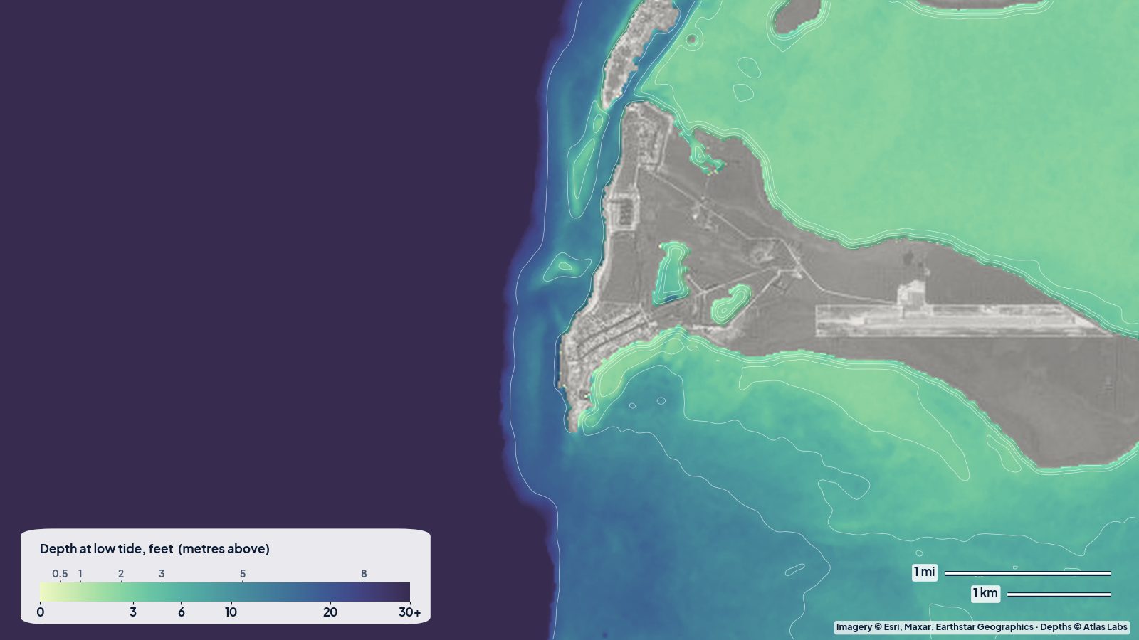
The real depth map of North and South Bimini at low tide. West of the islands the bottom drops into the Gulf Stream (one dark colour); east of them the pale green flats spread across the bank. Tap any spot on the live map for a number.
Approximate depth by zone
Typical ranges only. The tide range is roughly 2 to 3 ft (0.6 to 0.9 m), and it moves a lot of water across the flats. Check the live map and the tide.
- Harbour entrance and channel: cruising descriptions quote roughly 10 to 12 ft (3 to 3.7 m) in the dredged channel to the resort basin, with shifting shoals either side of the entrance.
- East Bimini flats: roughly 0 to 5 ft (0 to 1.5 m) over sand and grass; large areas dry or ankle deep at low tide.
- Mangrove creeks: roughly 2 to 6 ft (0.6 to 1.8 m) in the channels, with current.
- Sapona wreck: roughly 10 to 20 ft (3 to 6 m) around the hull, shallower on the sand side.
- Western shore reefs and the Bimini Road: roughly 10 to 25 ft (3 to 7.6 m).
- Shelf edge west of the island: drops from roughly 30 ft (9 m) to thousands of feet within a mile.
Access, launches and marinas
- Fast ferry and flights from Florida: the easiest way to arrive without a boat; day trips and overnight packages are common.
- North Bimini marinas (Alice Town, Bailey Town, the resort basin): slips, fuel, customs and rental golf carts and boats; kayak and paddleboard rentals at the resort.
- South Bimini (the airport side): marinas and a nature trail; small boats launch from the marina area.
- Private boats from Florida: the Gulf Stream crossing is about 50 miles (80 km) from Miami; clear customs in Alice Town. Trailerable boats are shipped or come across in settled weather.
- Bonefish guides: local guides launch skiffs from both islands and pole the east-side flats and creeks.
Best tide, wind and season
- Tide: Fish and paddle the flats on the rising tide, when bonefish move onto the sand from the creeks; at low tide much of the east side is too shallow even for a kayak, so plan to be in the creeks or channels. Enter the harbour with the tide in your favour and in good light.
- Wind: The east trade wind makes the western shore calm and the flats choppy; a westerly (common in winter fronts) flips that and makes the harbour entrance rough. The Gulf Stream crossing needs a window with no northerly component.
- Season: March to June for bonefish and settled crossings; summer is hot, calm and busy with weekenders from Florida; winter brings cold fronts, strong winds and fewer boats. Hurricane season peaks August to October.
Hazards
- The Gulf Stream crossing: A north wind against the north-flowing Stream builds steep, dangerous seas. Never cross with a northerly forecast.
- Harbour entrance shoals: The channel shifts and silts; follow current local guidance and arrive in daylight.
- Flats drying at low tide: Kayakers and skiffs get stranded on the east side; time your trip.
- Current in the creeks: Strong on big tides.
- Sharks: Bimini is a shark research hub for a reason; bull, lemon and nurse sharks are common, especially around the docks and the Sapona.
- Boat traffic and jet skis: The harbour and the resort basin are busy on summer weekends.
Kayak and skiff draft guidance
Kayaks and paddleboards (4 to 6 in, 10 to 15 cm of draft) are ideal for the east-side creeks and flats on a mid to high tide, and for the sheltered western beaches in trade winds. Plan around the tide; the flats empty fast.
Bonefish skiffs drawing 6 to 10 in (15 to 25 cm) pole the flats on the rising tide and run the creeks. Centre consoles and cruisers drawing 2 to 5 ft (0.6 to 1.5 m) should stay in the harbour channel and the deeper water west and south of the islands, visiting the Sapona by the marked approaches. Allow at least 1 ft (0.3 m) of margin above your draft on the flats, more on a falling tide.
Frequently asked questions
How deep is Bimini Harbour?
Cruising descriptions quote roughly 10 to 12 ft (3 to 3.7 m) in the dredged channel to the resort basin, with shifting shoals either side of the entrance. Arrive in daylight and follow current local guidance.
How deep are the Bimini flats?
Roughly 0 to 5 ft (0 to 1.5 m) over white sand and seagrass on the east side, with large areas drying at low tide.
How deep is the Sapona wreck?
Roughly 10 to 20 ft (3 to 6 m) around the hull, which makes it an easy snorkel and freedive in calm conditions.
Can I kayak in Bimini?
Yes. The east-side creeks and flats on a rising tide and the western beaches in an east wind are both excellent, and rentals are available on North Bimini.
Is Bimini good for spearfishing?
Yes, on the reefs and the shelf edge, but only with Bahamian free-diving rules (no tanks, no spear guns; pole spears and Hawaiian slings only) and outside protected areas. Check current regulations.
Related reading
Safety note: ShoalScope depth maps are satellite estimates for planning only and are not for navigation. Harbour shoals shift and the Gulf Stream crossing is serious. Use official charts, a weather window, and local guidance.