For most boaters coming from Florida, Bimini and the cays south of it, Gun Cay and Cat Cay, are the first look at the Bahamas, and the first lesson in how fast the water changes there. One moment you are in the deep blue of the Gulf Stream, a few hundred yards later you are over white sand in water you can see every ripple of. This guide reads our live depth map of the area, from North Bimini down to Cat Cay.
Depths are at low tide. The tide range is about 2.5 to 3 ft. The map’s typical error is about 2 ft: good for seeing where the flats, the bank and the drop-off are, not for exact clearance in a keel boat.
North and South Bimini
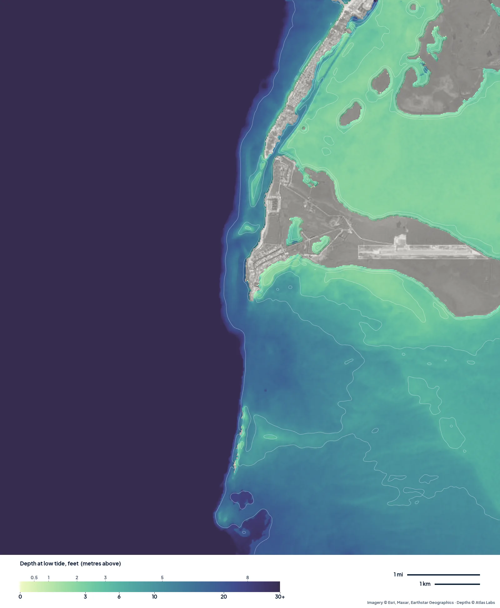
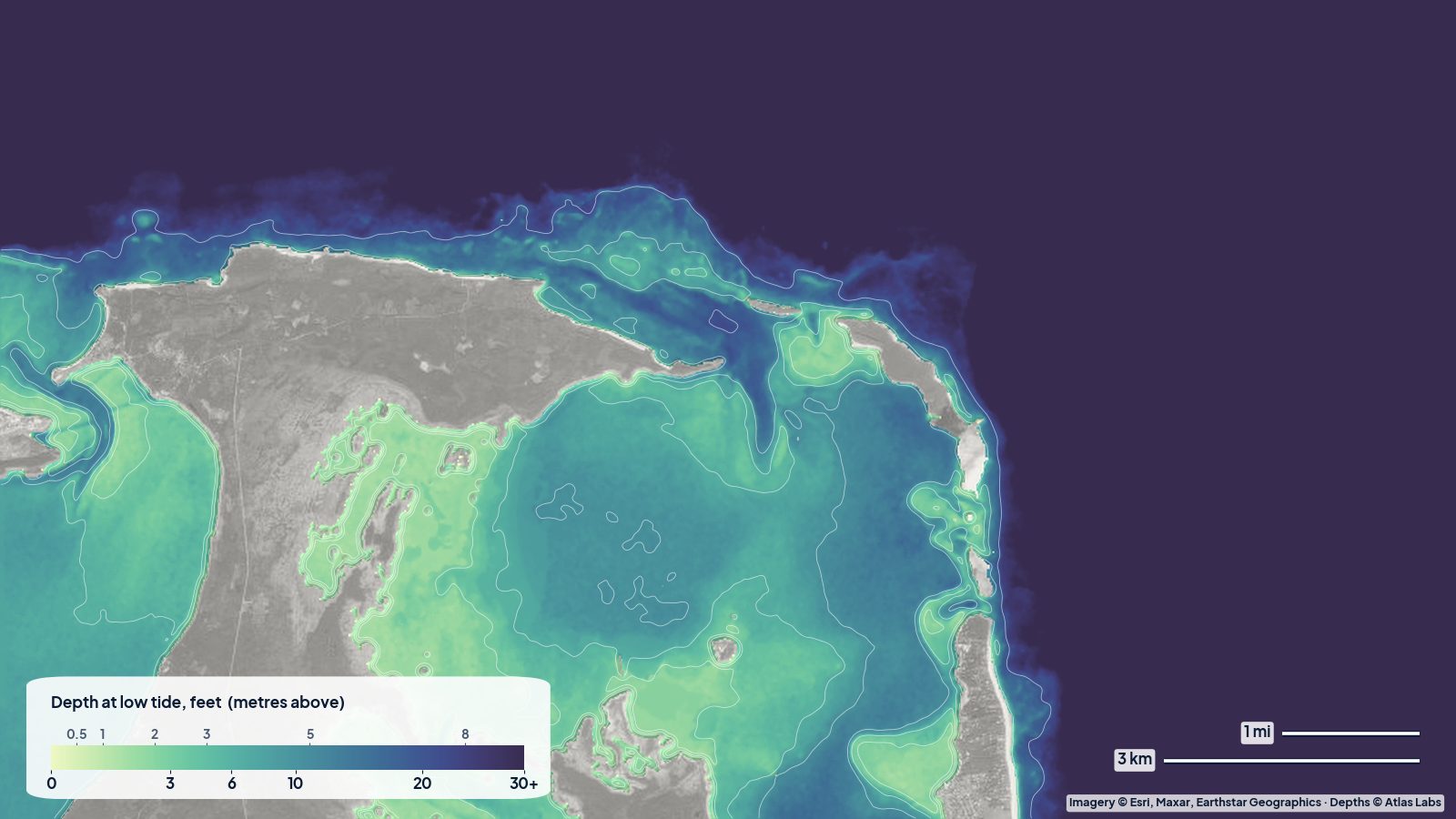
North and South Bimini at low tide. The Gulf Stream to the west is one dark colour; the flats spread east behind the islands.
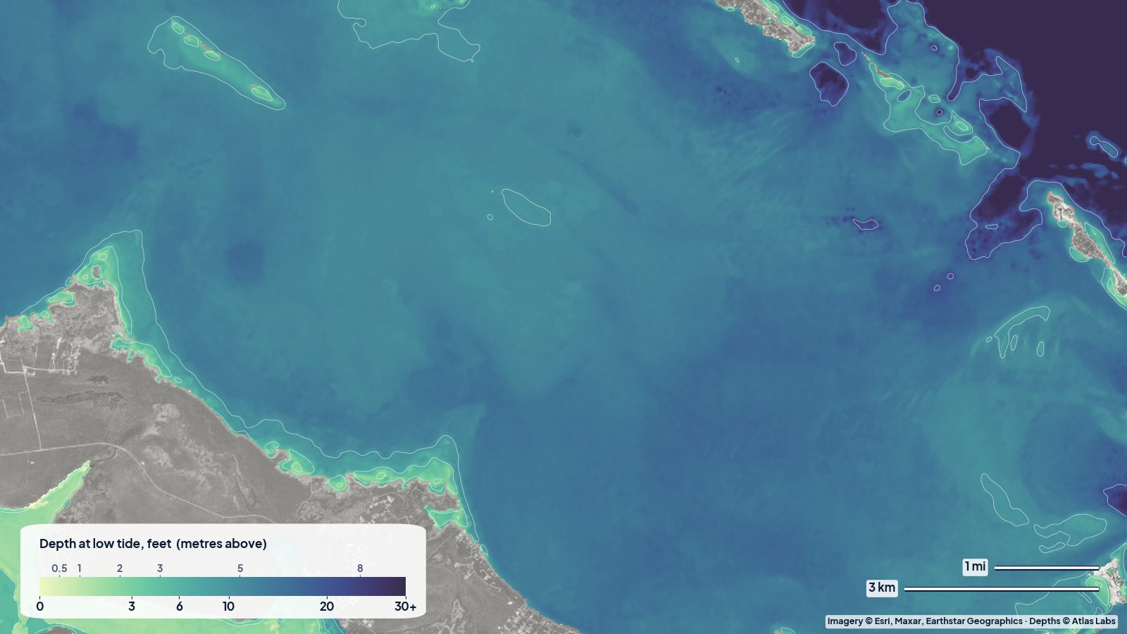
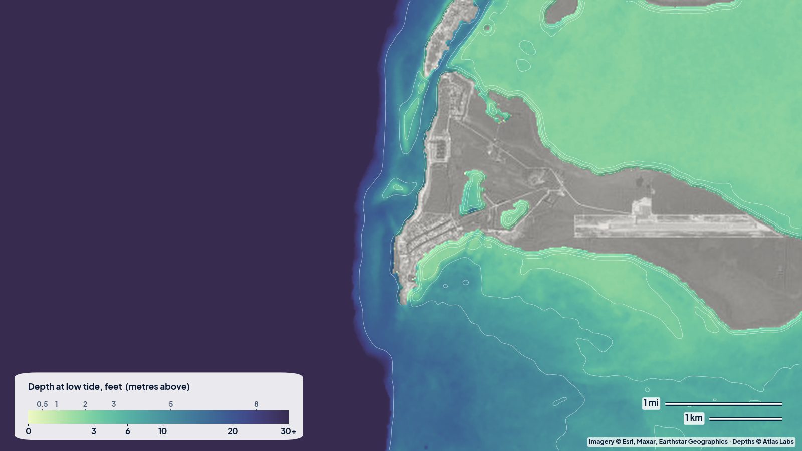
The map tells the Bimini story in one picture. The west side drops off almost at the beach. Behind the islands to the east, the flats between North and South Bimini read 2 to 3 ft across wide areas, the classic bonefish water. Further out onto the bank east of South Bimini, the map reads around 5 to 7 ft.
The harbour between the islands is a mix: the map reads deeper water in the middle (around 11 to 13 ft) and shallow edges that read 2 to 3 ft. That is the reason everyone talks about the harbour entrance: stay in the deeper water and come in on a rising tide if you have any doubt.
Gun Cay and Cat Cay
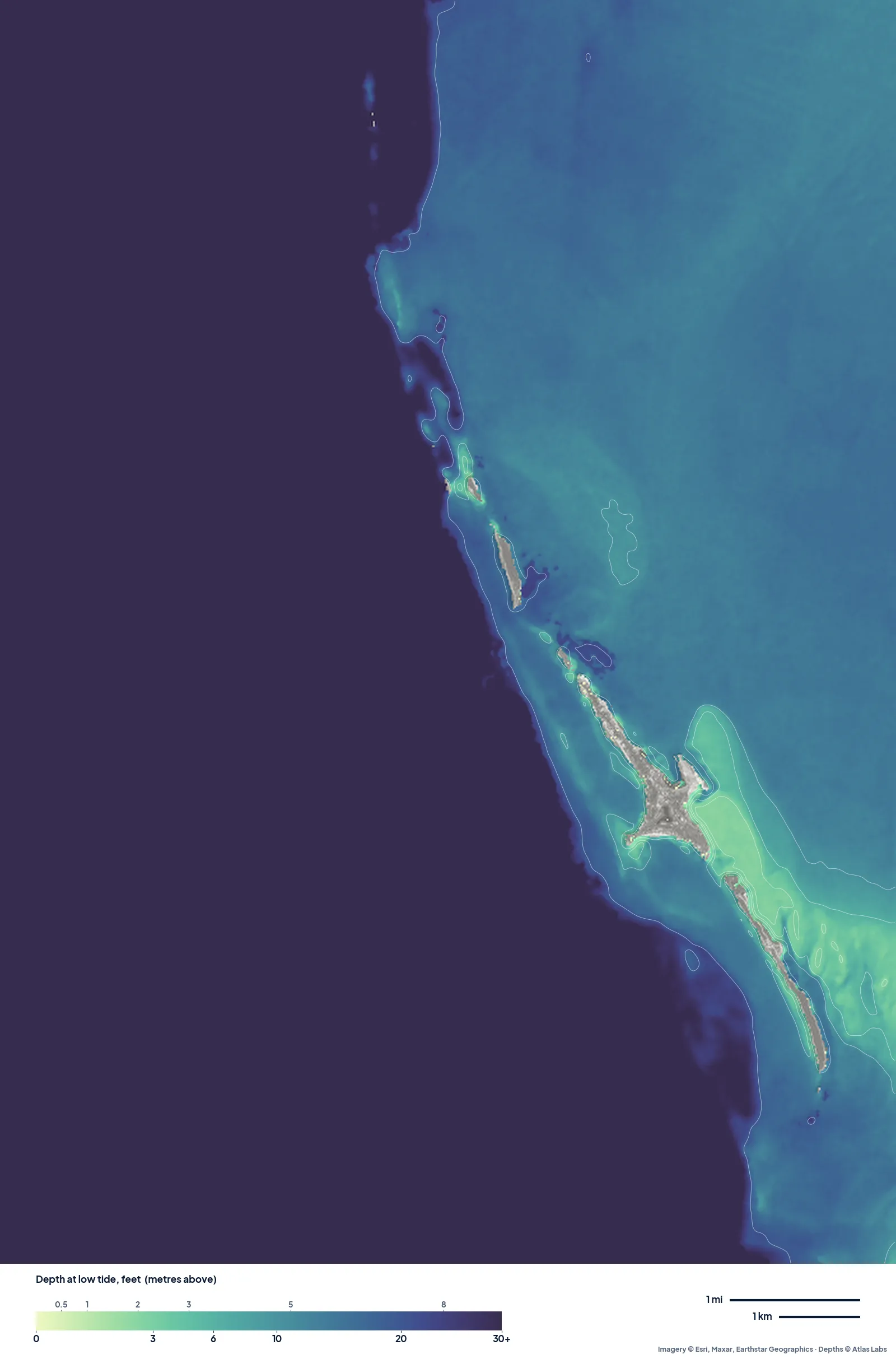
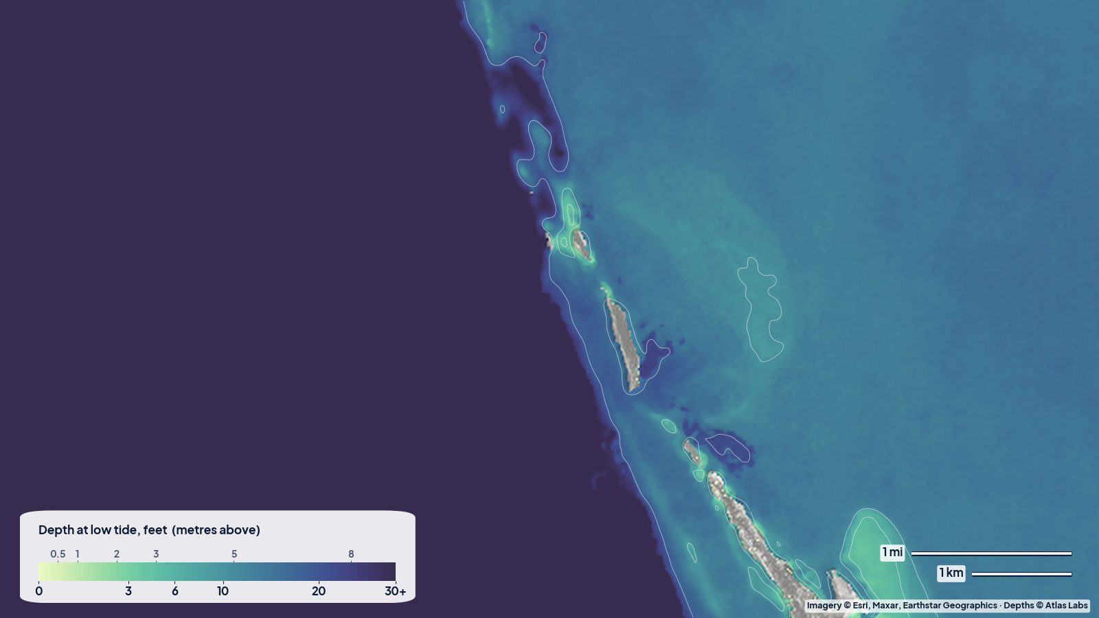
Gun Cay and Cat Cay at low tide. The thin line of cays sits right on the bank edge; behind it, the bank is an even 13 to 15 ft.
South of Bimini, the cays are a thin line right on the edge of the bank. Behind them, the bank is remarkably even: east of Cat Cay the map reads 13 to 14 ft over a wide area, and the open water south and east of Gun Cay is similar. Around Gun Cay itself the depth varies more, from shallow sand by the beaches to deeper water in the cut, with the map reading roughly 15 to 23 ft close to the cay.
That even 13 to 15 ft is why Gun Cay Cut is a popular way onto the bank for boats heading east toward the Berry Islands or Nassau: once you are through, there is plenty of water for most cruising boats in daylight.
Planning tips
- Crossing from Florida: pick a day without a north wind against the Gulf Stream. The map does not show waves, but the Stream with a norther in it is no place for a small boat.
- Flats fishing and kayaking: the 2 to 3 ft water east of North Bimini is the place. Go on the last of the falling tide and the first of the rise.
- Snorkelling: the clear sand around Gun Cay and the cays is easy and shallow. Stay well clear of the cuts on a running tide.
- Anchoring: the even bank behind the cays gives sand at a predictable depth; anchor in the lee and watch for wind shifts when fronts pass.
Open the live map
Tap any spot for the depth in feet: Bimini live map. For the harbour, the Sapona wreck and access details see the full Bimini depth guide, and for the rest of the islands the Bahamas spot hub.
Frequently asked questions
How deep are the Bimini flats?
On our map, the flats behind North Bimini read about 2 to 3 ft at low tide over wide areas, a little more on the open bank east of South Bimini.
How deep is the bank behind Cat Cay and Gun Cay?
The map reads an even 13 to 14 ft east of Cat Cay, deepening a little around Gun Cay and in the cut.
Is the water deep right off Bimini’s west beach?
It drops very quickly into the Gulf Stream, which is why the map shows it as one dark colour within a short distance of the shore.
Related reading
- Bimini depth map: the flats, the harbour and the Gulf Stream edge
- Exumas sandbanks around Staniel Cay
- Biscayne Bay shoals: the Safety Valve and Stiltsville
Safety note: ShoalScope depth maps are satellite estimates for planning, not for navigation. Use official charts and current cruising guides, check the Gulf Stream forecast, and enter harbours in good light.