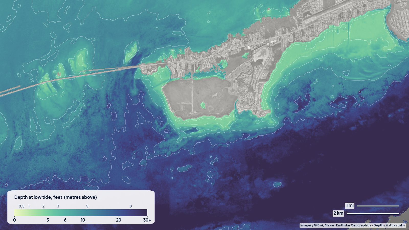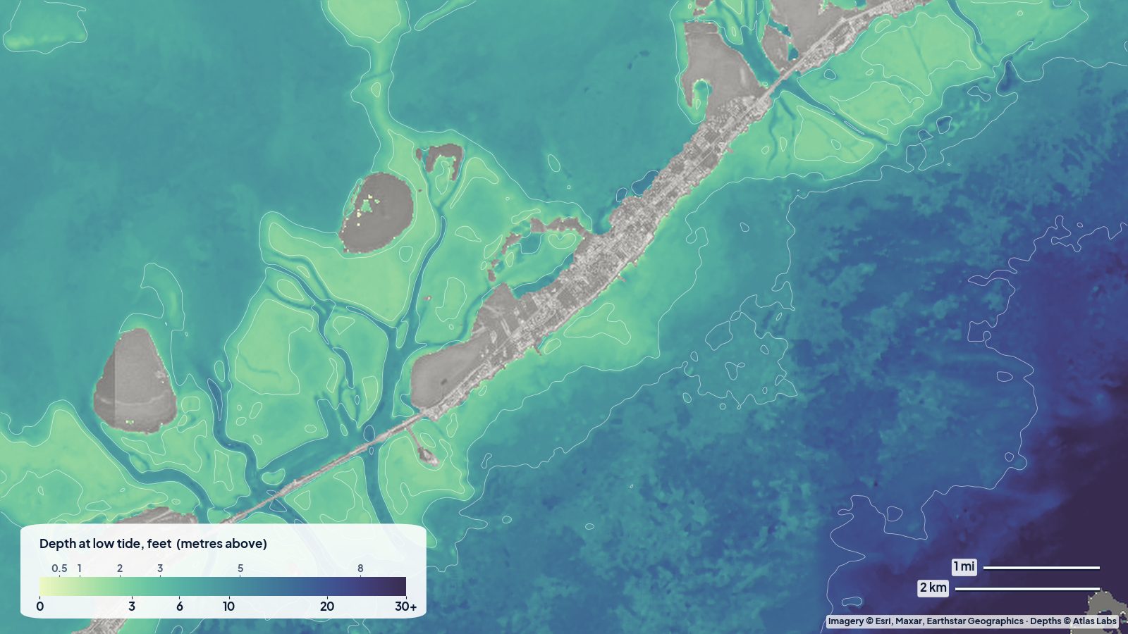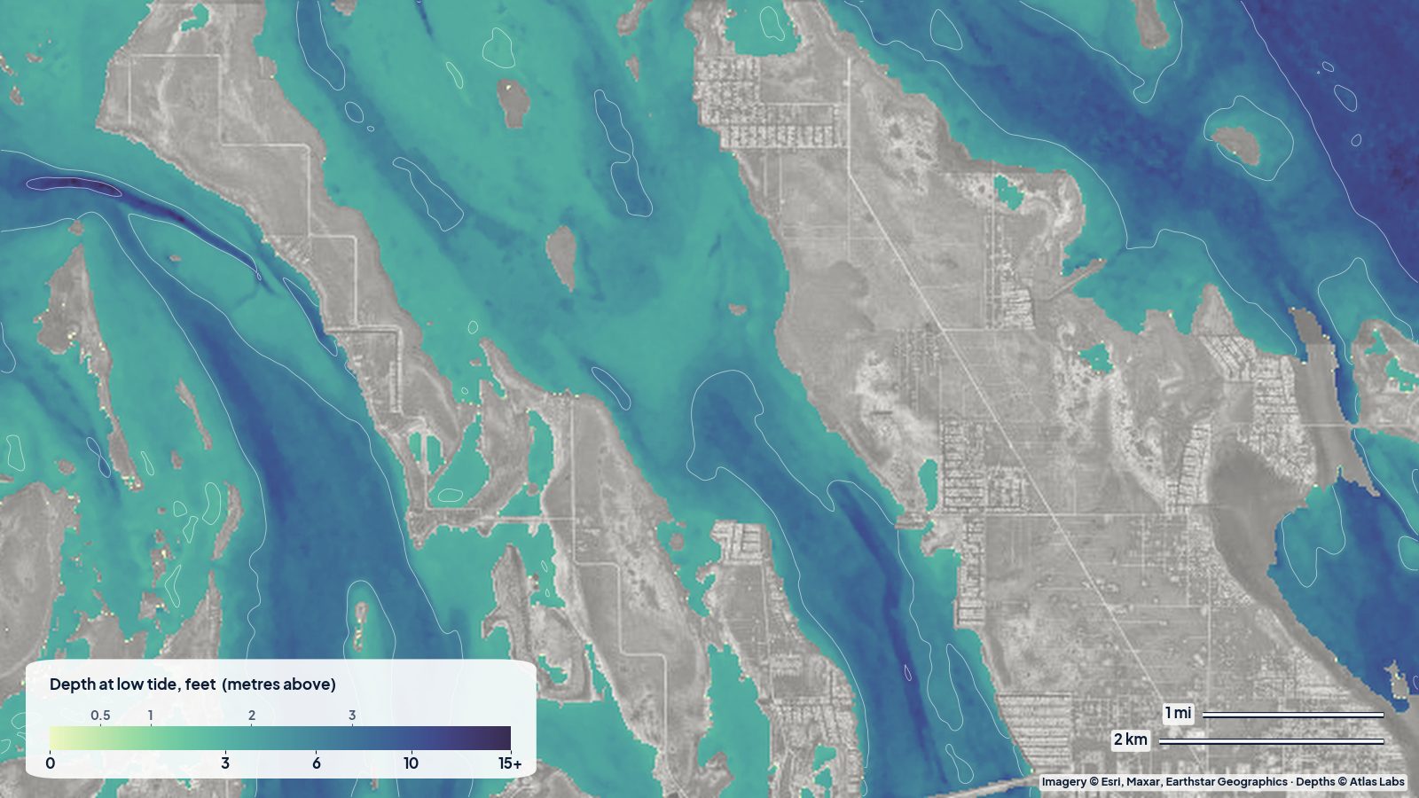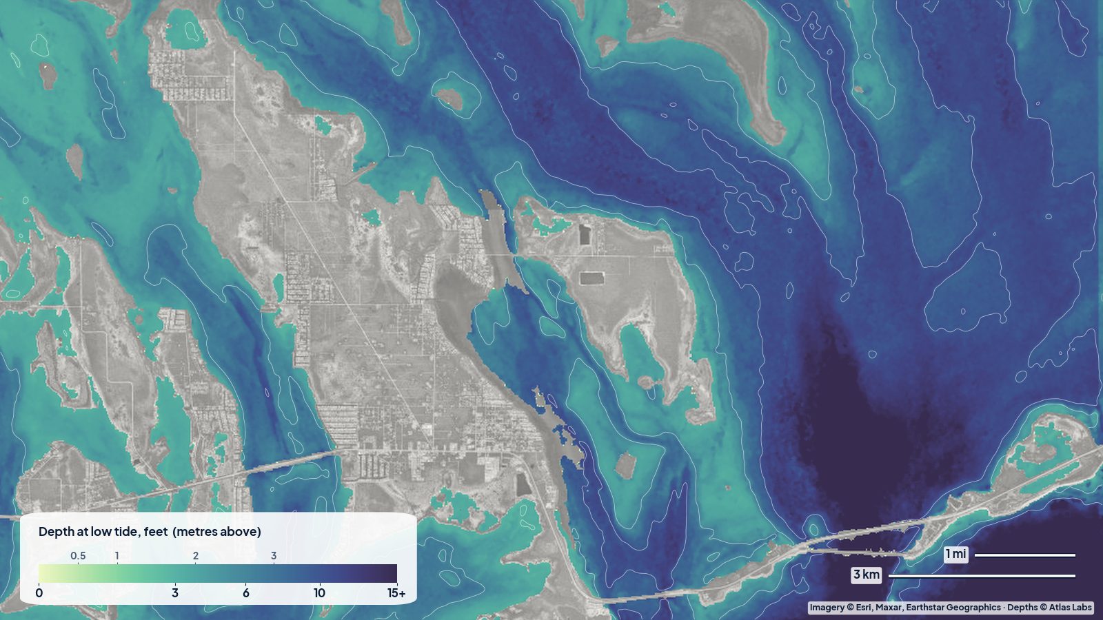
Bahia Honda is the Lower Keys island just west of the Seven Mile Bridge, and its state park is famous for two things: beaches that feel like the Bahamas, and the broken old railroad bridge that frames every photo. For paddlers, snorkelers and small-boat owners it is also one of the easiest places in the Keys to get into clear, shallow water within minutes of the car. Here is how the depth lays out, where to put in, and what to watch for. The satellite depth map for this cell is updated regularly and is the best way to see today’s picture.
What the bottom looks like
Bahia Honda has an oceanside and a bayside separated by the island and a deep natural channel.
- Oceanside (Sandspur Beach, Calusa Beach area): white sand close in, giving way to turtle grass, then scattered hard bottom and patch coral. Visibility is usually excellent on calm days.
- The Bahia Honda channel: the gap between Bahia Honda and Spanish Harbor Key under the old and new bridges is one of the deepest natural passes in the Keys. Current runs hard here on both tides.
- Bayside (Gulf) flats: broad grass and sand flats dotted with small mangrove keys and a few sandy spoil islands, continuing north into the backcountry.
- Loggerhead Beach and the lagoon: a sheltered, shallow basin inside the park that is ideal for beginners and children.
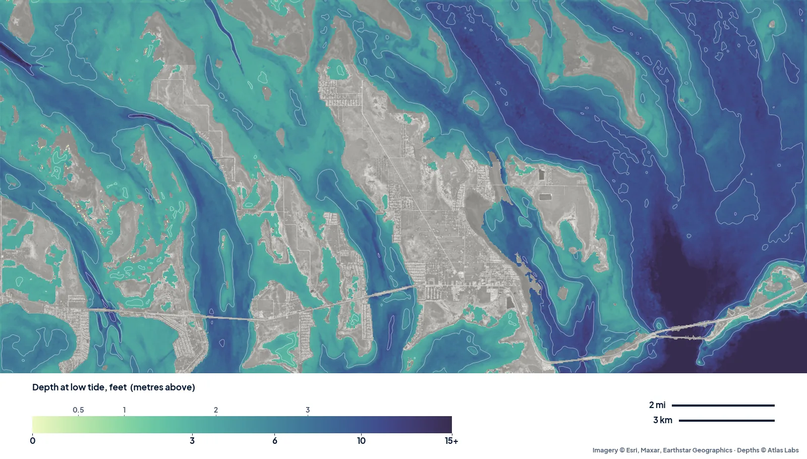
The real depth map from Big Pine Key to Bahia Honda at low tide. The long blue fingers are the natural channels between the banks; the pale green is the flats you can pole or paddle. Tap any spot on the live map for a number.
Approximate depth by zone
Typical ranges only. Depth depends on tide and the exact spot, so check the live map before you launch.
- Beach swimming areas (Calusa, Loggerhead, Sandspur): roughly 1 to 5 ft (0.3 to 1.5 m) within the first hundred yards.
- Oceanside grass and patch reef off Sandspur: roughly 4 to 12 ft (1.2 to 3.7 m), deepening gradually toward Hawk Channel.
- Bahia Honda channel under the bridges: locally among the deepest water in the Keys, often described as 20 ft (6 m) or more in the middle. Avoid it in a kayak on a running tide.
- Bayside flats north and west of the park: roughly 1 to 4 ft (0.3 to 1.2 m), with banks that nearly dry on a spring low.
- Backcountry channels between the bayside keys: roughly 4 to 8 ft (1.2 to 2.4 m).
Launch points and boat ramps
- Bahia Honda State Park boat ramp: a paved ramp inside the park (entrance fee) with trailer parking; suits skiffs and small centre consoles.
- Calusa Beach and Loggerhead Beach: carry-in launches for kayaks and paddleboards straight from the sand. The park concession rents kayaks and snorkel gear.
- Spanish Harbor Key and Little Duck Key: small roadside launches on the US-1 causeways on either side of the bridge; useful for a quick paddle to the flats, but parking is limited.
- Sandspur Beach: longer walk from the car but direct access to the oceanside grass and reef.
Best tide, wind and season
- Tide: Snorkel the oceanside on a rising tide for the clearest water. Paddle the bayside flats on a mid to high tide so you float over the grass. Avoid the bridge channel within two hours either side of maximum current.
- Wind: Easterly trade winds make the bayside and the lagoon the calm choice; a north wind flips that and the oceanside beaches go flat.
- Season: December to April brings the clearest, most comfortable days and the biggest crowds; the park often reaches capacity by mid-morning in peak weeks. Summer is calm and hot with afternoon storms, and the water is at its warmest for snorkeling.
Hazards
- Current under the bridge: The pass runs hard enough to sweep a kayak out to Hawk Channel or into the Gulf. Keep paddleboards and beginners well away from the span.
- Boat traffic: The channel is a main route for boats moving between Gulf and Atlantic. Cross it quickly and at right angles if you must.
- Sea urchins and hard bottom: Wear reef shoes on rocky shorelines and never stand on coral.
- Grass flats at low tide: Running a skiff onto a bayside bank damages protected seagrass and your prop.
- Weather: Summer storms build quickly over the Gulf and move toward the Keys in the afternoon.
Kayak and skiff draft guidance
Kayaks and paddleboards (4 to 6 in, 10 to 15 cm of draft) can go almost anywhere here at mid tide. On a spring low, the bayside banks will stop you; follow the darker channels shown on the map.
A poling skiff with 6 to 10 in (15 to 25 cm) of draft can work the bayside flats and the oceanside grass with care. Boats drawing more than 12 in (30 cm) should stay in the channel and the deeper oceanside water and treat the flats as off limits except at high tide. Plan to float at least 1 ft (0.3 m) above your draft to allow for wind-driven water drops.
Frequently asked questions
How deep is the water at Bahia Honda beach?
The swimming areas at Calusa and Loggerhead beaches are typically 1 to 5 ft (0.3 to 1.5 m) close to shore. Sandspur Beach shelves a little more quickly. Depth changes with the tide, so check the live map.
Can you snorkel from the beach at Bahia Honda?
Yes. The grass beds and scattered rock off Calusa and Sandspur hold plenty of fish in 4 to 10 ft (1.2 to 3 m) of water. The offshore Looe Key reef needs a boat trip.
Is it safe to kayak under the Bahia Honda bridge?
Only for experienced paddlers near slack tide. The channel is deep and fast and leads straight to open water.
Is there a boat ramp at Bahia Honda State Park?
Yes, a paved ramp inside the park with a fee. It is popular, so arrive early on winter weekends.
How shallow is the bayside of Bahia Honda?
Most of the open bayside flats are 1 to 4 ft (0.3 to 1.2 m), with some banks nearly dry at low spring tides.
Related reading
- Marathon and Seven Mile Bridge flats depth map
- Upper Keys backcountry depth map
- Biscayne Bay depth map
Safety note: ShoalScope depth maps are satellite estimates for planning only. They are not for navigation. Carry official charts, check the tide, and wear a life jacket.