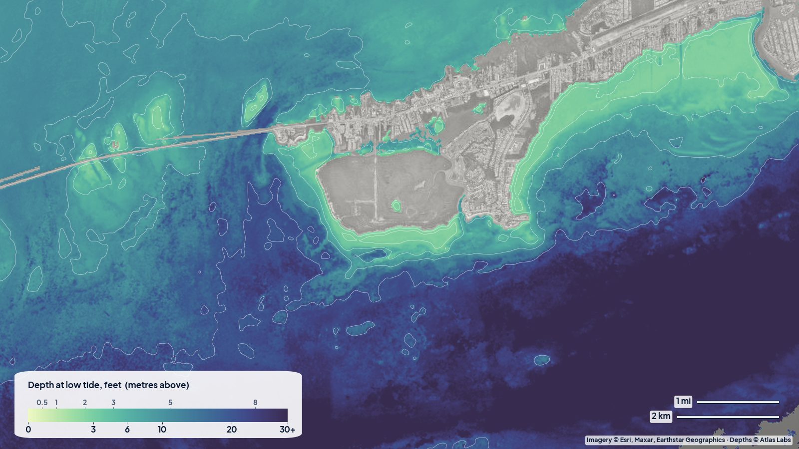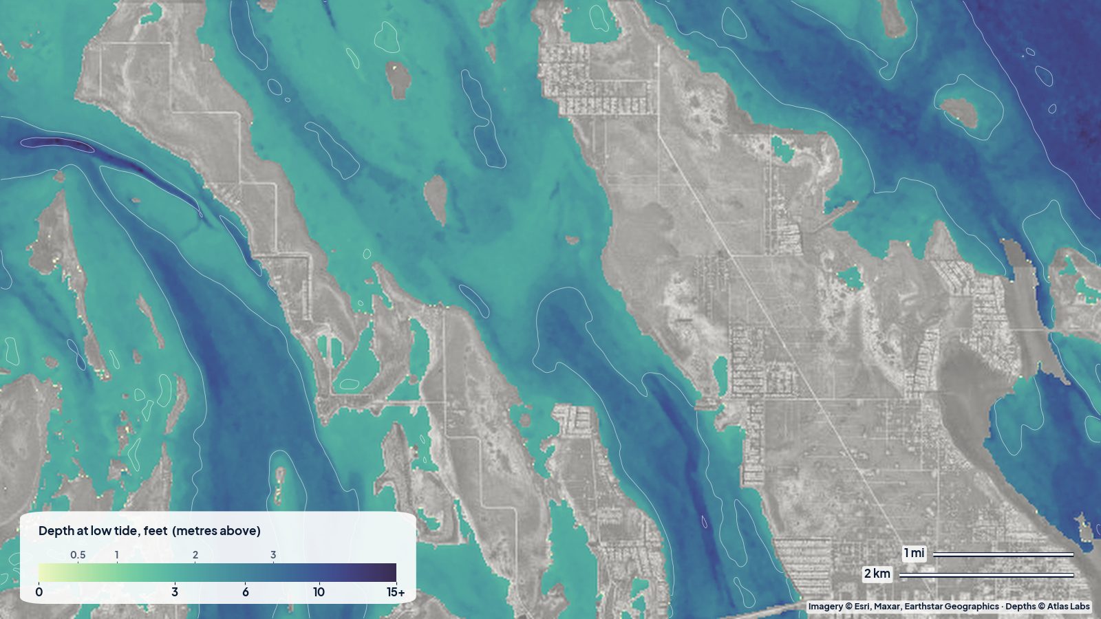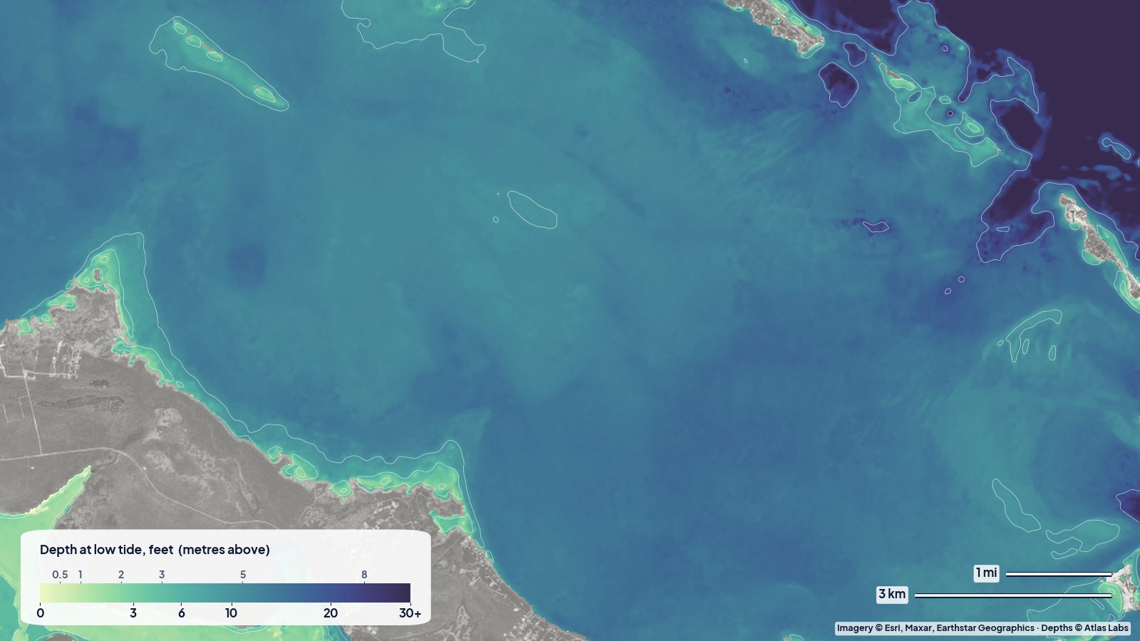
The Upper Keys, from Key Largo down through Tavernier and Islamorada, are where most first-time visitors meet the backcountry. On the bayside you have a maze of shallow basins, banks and mangrove islands that fade into Florida Bay and Everglades National Park. On the oceanside you have grass flats, patch reefs and the famous shallow reefs of John Pennekamp Coral Reef State Park. This guide covers both sides in plain terms: what the bottom is, how deep it typically runs, where to launch, and what to avoid. The satellite depth map for this area is updated regularly; use it alongside the tide before every trip.
What the bottom looks like
Bayside (Everglades side) off Islamorada and Tavernier: a series of shallow basins floored with turtle grass and soft mud, separated by sand and grass banks that nearly dry at low water. Natural channels thread between them. Water colour ranges from clear green to milky after wind. Mangrove islands dot the whole area.
Blackwater Sound, Tarpon Basin and Buttonwood Sound (Key Largo bayside): larger, slightly deeper basins connected by narrow creeks and the Intracoastal route. The bottom is mostly grass and soft sediment.
Oceanside flats: hard sand and grass out to about a mile, then Hawk Channel, then the reef tract. Off Key Largo the patch reefs inside the main reef, including those near Pennekamp, are some of the shallowest, most-visited coral in the US.
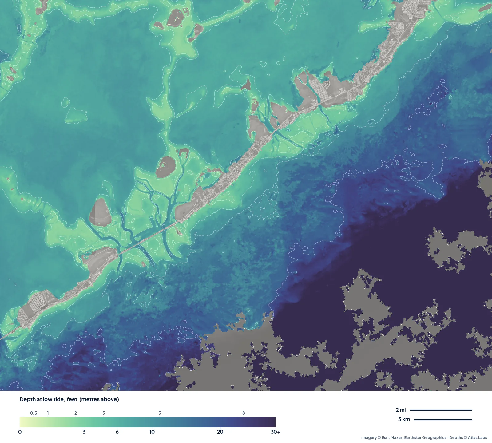
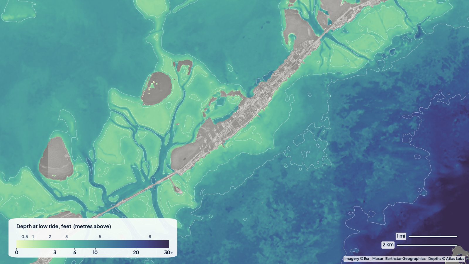
The real depth map around Islamorada at low tide. The backcountry banks show as pale green bands cut by narrow blue channels; the oceanside drops away toward the reef. Tap any spot on the live map for a number.
Approximate depth by zone
These are typical values and not surveyed depths. Check the live map for your exact spot and date.
- Backcountry banks (bayside): often under 1 ft (0.3 m) at low tide; many dry on a winter spring low.
- Backcountry basins between the banks: roughly 2 to 6 ft (0.6 to 1.8 m).
- Natural channels and creeks (Tavernier Creek, Snake Creek, Whale Harbor): roughly 5 to 10 ft (1.5 to 3 m), strong current.
- Blackwater Sound and Buttonwood Sound: roughly 4 to 9 ft (1.2 to 2.7 m) over most of the basin.
- Oceanside grass flats: roughly 2 to 6 ft (0.6 to 1.8 m) in the first mile.
- Pennekamp patch reefs and shallow snorkel sites: roughly 5 to 20 ft (1.5 to 6 m); the most popular shallow spots sit in about 8 to 15 ft (2.4 to 4.6 m).
- Hawk Channel: mid-teens to 30 ft (4.5 to 9 m).
Launch points and boat ramps
- John Pennekamp Coral Reef State Park (Key Largo): paved ramp, kayak rentals and a sheltered mangrove paddling trail; entrance fee and busy winter weekends.
- Florida Bay Outfitters area and Blackwater Sound launches (Key Largo bayside): easy kayak access to the big sounds.
- Tavernier Creek Marina launch (Tavernier): direct kayak access to the backcountry creeks and basins.
- Anne’s Beach (Lower Matecumbe, Islamorada): free roadside carry-in launch onto oceanside flats that are perfect for paddleboards.
- Indian Key Fill and the Lignumvitae Key area: roadside launches used to reach the state park islands and bayside banks.
- Public and marina ramps in Islamorada (Founders Park, Whale Harbor, Robbie’s area): skiff and bay-boat access to both sides.
Best tide, wind and season
- Tide: For the backcountry, go on the rising half of the tide and come back before the fall leaves you dragging across a bank. For the oceanside flats and patch reefs, the incoming tide brings the clearest water from offshore.
- Wind: The bayside is sheltered in an easterly trade wind, the oceanside in a northerly. On strong winds of any direction the open basins get choppy and silty fast.
- Season: December to April is the prime visitor season and has the lowest winter tides, so banks dry more. Summer gives calm, clear mornings, hot afternoons and thunderstorms; it is the best time for snorkeling the reef.
Hazards
- Grounding on banks: The backcountry is a patchwork of ankle-deep banks. A skiff pushed onto grass at low tide may wait hours to float off and will scar protected seagrass.
- Creek currents: The oceanside creeks (Tavernier, Snake, Whale Harbor) run hard and carry heavy boat traffic. Paddlers should cross at slack if possible.
- Boat traffic: Islamorada is a sportfishing hub; marked channels are busy from dawn.
- Coral heads: Patch reefs rise suddenly from sand. Anchor only in sand and use mooring buoys where provided.
- Crocodiles and no-motor zones: Parts of the bayside fall in Everglades National Park with pole-and-troll and no-motor zones. Check park rules.
Kayak and skiff draft guidance
A kayak or paddleboard (4 to 6 in, 10 to 15 cm) floats over nearly all of the backcountry at mid to high tide. At low tide expect to walk or detour around banks; the live map shows where the deeper basins connect.
Poling skiffs with 6 to 10 in (15 to 25 cm) of draft are the right tool here, running the channels and poling the edges. Bay boats drawing 12 to 18 in (30 to 45 cm) should stay in marked channels and basins the map shows as 3 ft (0.9 m) or more, and should treat the backcountry banks as closed below mid tide. Always keep a margin of 1 ft (0.3 m) above your draft, more when a north wind is pushing water out of the bay.
Frequently asked questions
How deep is the water at John Pennekamp?
The shallow snorkel sites inside the park are typically 5 to 20 ft (1.5 to 6 m), with the most popular patch reefs in about 8 to 15 ft (2.4 to 4.6 m). Beach and mangrove-trail water is shallower.
How shallow is the Islamorada backcountry?
Very. Banks are often under 1 ft (0.3 m) at low tide and the basins between them are usually only 2 to 6 ft (0.6 to 1.8 m).
Where can I kayak for free in Islamorada?
Anne’s Beach is the classic free carry-in launch on the oceanside. Indian Key Fill and several roadside pull-offs also work.
Can I take a bay boat into the Everglades backcountry from Islamorada?
Only in the channels and deeper basins on a rising tide, and only outside the park’s no-motor zones. Most of the area is better suited to kayaks and poling skiffs.
When is the best time to fish the Upper Keys flats?
Late winter and spring for bonefish and permit as the water warms; tarpon arrive in force from April to June. The backcountry fishes year round for redfish and snook.
Related reading
Safety note: ShoalScope depth maps are satellite estimates for planning only and are not for navigation. Carry official charts, respect park zones, check the tide and wear a life jacket.