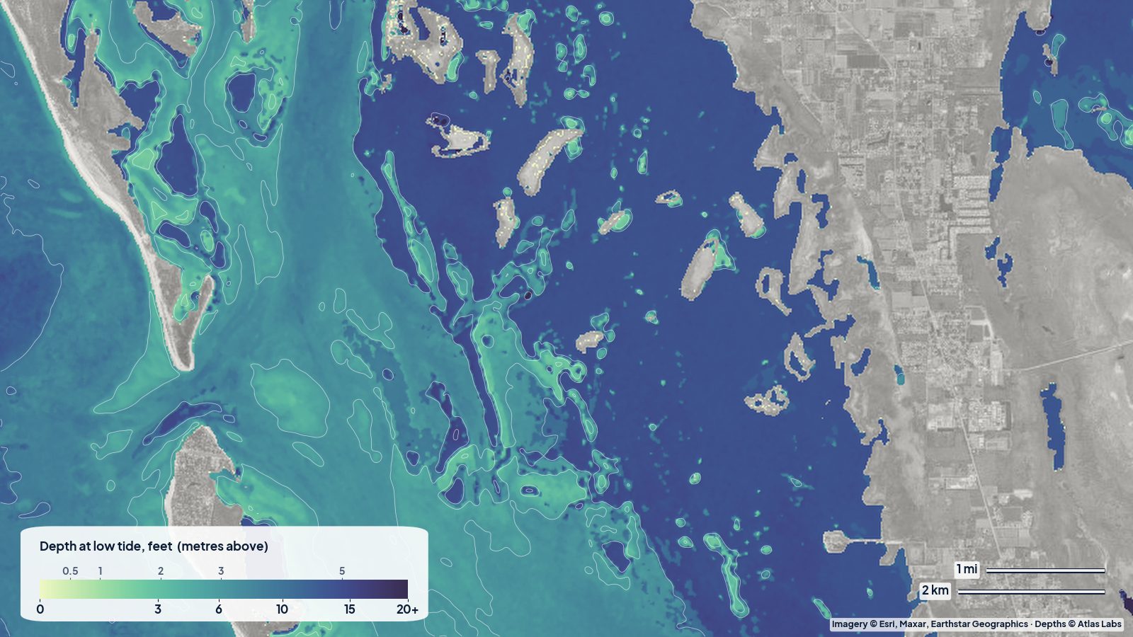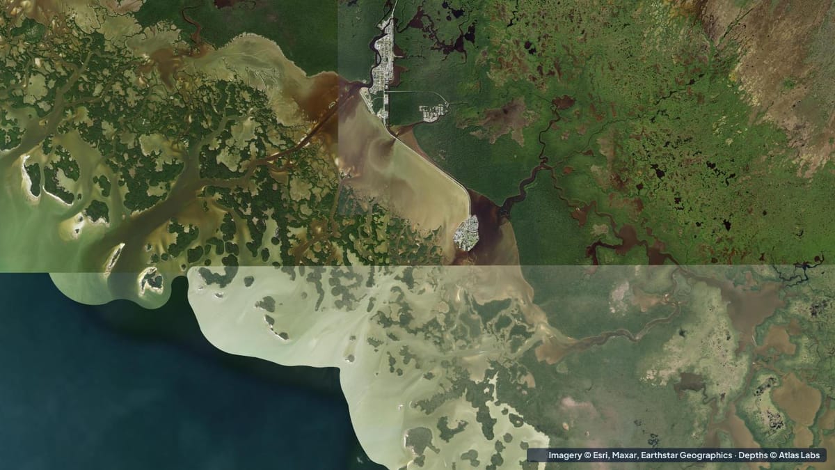
The Ten Thousand Islands are the mangrove archipelago that fringes the south-west corner of the Everglades, from Marco Island down past Chokoloskee and Everglades City to Cape Sable. Nobody has counted them, but the name is not far off: hundreds of mangrove keys separated by shallow bays, oyster bars and tidal passes that open onto the Gulf of Mexico. It is the northern gateway to the 99 mile (160 km) Wilderness Waterway and some of the wildest paddling in the United States. It is also shallow, muddy and confusing. This guide lays out the typical depths zone by zone, the launch points, and the hazards that matter. The satellite depth map for this cell is updated regularly.
What the bottom looks like
- Inner bays (Chokoloskee Bay, the back bays behind the islands): soft mud and silt with scattered oyster bars and grass, often tea coloured from the mangroves. Many of these bays go nearly dry at low tide.
- Oyster bars: the signature feature. Hard, sharp ridges of living oyster at the mouths of creeks and along the edges of passes, awash at mid tide and exposed at low.
- Passes between the outer islands (Indian Key Pass, Rabbit Key Pass, Chokoloskee Pass): channels scoured by strong tidal current, with sand and shell bottoms and sandbars at their Gulf mouths.
- Gulf beaches on the outer keys (Indian Key, Pavilion Key, Rabbit Key, Tiger Key): white shell and sand beaches shelving into clear, shallow Gulf water. These are the Wilderness Waterway beach campsites.
- Offshore Gulf: a shallow shelf that stays under 10 ft (3 m) for a mile or more.
Approximate depth by zone
Typical ranges only. Wind pushes water in and out of these bays as much as the tide does; always check the live map and the forecast.
- Inner bays and back country: roughly 1 to 3 ft (0.3 to 0.9 m) at mid tide, with mud flats drying at low water.
- Chokoloskee Bay: mostly 1 to 4 ft (0.3 to 1.2 m), with the marked channel to Everglades City deeper.
- Marked channels (Indian Key Pass to Everglades City): roughly 5 to 10 ft (1.5 to 3 m).
- Passes between the outer islands: roughly 6 to 15 ft (1.8 to 4.6 m) in the throat, shoaling to 1 to 3 ft (0.3 to 0.9 m) over the bars at their mouths.
- Gulf beaches on the outer keys: roughly 1 to 5 ft (0.3 to 1.5 m) close in.
- Gulf shelf out to a mile offshore: roughly 4 to 10 ft (1.2 to 3 m).
Launch points and boat ramps
- Gulf Coast Visitor Center, Everglades City (Everglades National Park): the main kayak launch for the park’s western side, with rentals, permits for backcountry camping and a ramp for small boats.
- Chokoloskee Island: public and marina ramps and kayak launches, closest to the outer keys and Rabbit Key Pass.
- Everglades City public ramps and marinas: trailer ramps for skiffs and bay boats working the passes.
- Port of the Islands: a marina and ramp on the Faka Union Canal, giving access to the northern islands.
- Goodland and Marco Island ramps: access to the northern end of the islands and the Cape Romano shoals.
Best tide, wind and season
- Tide: This is a tide-driven place. Paddle out on the ebb and come back on the flood, or vice versa, and plan to cross inner bays and bars within two hours of high water. Low spring tides strand boats and paddlers on mud.
- Wind: The inner bays are sheltered by mangroves; the outer keys and passes are exposed to westerlies, which build a short, steep chop on the shallow Gulf.
- Season: November to April is the dry season: comfortable, few bugs and the best time for multi-day trips. May to October is hot, wet and thick with mosquitoes and no-see-ums, but the fishing in the creeks is excellent at dawn.
Hazards
- Getting lost: Hundreds of identical mangrove islands. Carry a GPS, a compass and a chart, and mark your launch.
- Oyster bars: They cut feet, kayak hulls and skiff gelcoat, and they stop boats dead at speed.
- Mud: Stepping out of a kayak on a mud flat can mean sinking to the knee or worse. Stay in the boat and wait for water.
- Current in the passes: Strong, especially around new and full moons.
- Wildlife and bugs: Alligators and crocodiles are present; mosquitoes in summer are genuinely dangerous without protection.
- Remoteness: No cell signal across most of the area. Carry a VHF radio or a satellite messenger.
Kayak and skiff draft guidance
Kayaks and canoes (4 to 6 in, 10 to 15 cm of draft) are the ideal craft, and even they get stranded on mud at low tide. Plan routes along the channels and passes shown on the map, and time inner-bay crossings for high water.
Poling skiffs drawing 6 to 10 in (15 to 25 cm) are how guides fish the back bays, running the marked channels and poling the oyster-bar edges. Bay boats drawing 12 to 18 in (30 to 45 cm) should keep to the marked channels and the passes and treat the inner bays as closed except at high tide. Keep at least 1 ft (0.3 m) of margin above your draft, and more when a northerly is blowing water out of the bays.
Frequently asked questions
How deep is the water in the Ten Thousand Islands?
Mostly shallow: 1 to 3 ft (0.3 to 0.9 m) in the inner bays at mid tide, with mud flats drying at low water. Only the passes and marked channels hold 5 ft (1.5 m) or more.
Where do I launch a kayak for the Ten Thousand Islands?
The Gulf Coast Visitor Center in Everglades City and the launches on Chokoloskee Island are the main starting points, with rentals and backcountry camping permits available.
Can a bay boat fish the Ten Thousand Islands?
Yes, in the passes, the marked channels and the Gulf side of the outer keys. The inner bays are skiff and kayak territory.
When is the best time to paddle the Ten Thousand Islands?
November to April, for cooler weather, fewer bugs and settled conditions.
Are there beaches to camp on?
Yes. Several outer keys have designated beach campsites managed by Everglades National Park; a permit is required.
Related reading
- Florida Bay and Flamingo depth map
- Pine Island Sound and Captiva depth map
- Marathon and Seven Mile Bridge flats
Safety note: ShoalScope depth maps are satellite estimates for planning only and are not for navigation. Tannin-stained water and mud flats make this area hard to map and harder to run. Carry official charts, a GPS and a VHF radio, and wear a life jacket.